 |
Terlingua
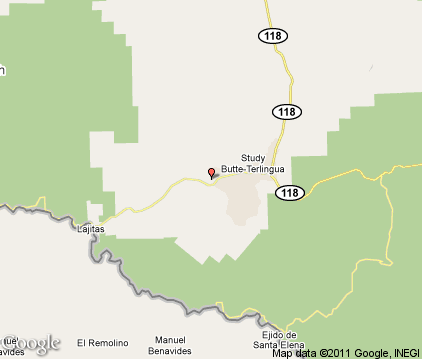
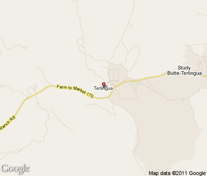
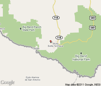
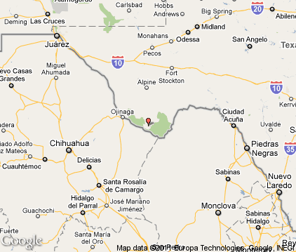
is a ghost town, or mining district, located in Brewster County in west Texas' Big Bend Region. It's located near the Rio Grande River and the villages of Lajitas, Study Butte and the Mexican village of Santa Elena. Today, the town is mostly a tourist destination for visitors going to Big Bend National Park. The town was established in the mid-1800s when cinnabar (from which the metal mercury is extracted,) was discovered in the area. At one time the town had a population of around 2,000 people. The remains of the town include several abandoned and capped mines and the old mining company. There are recreational opportunities in the Terlingua area, including mountain biking, rafting on the Rio Grande, hiking, motorcycling and camping. Each year, on the first Saturday in November, over 10,000 people who call themselves "chili heads" gather in Terlingua for two chili cook-offs: the Chili Appreciation Society International and the Frank X. Tolbert / Wick Fowler World Chili Championships. One of the original founders of the chili cook-off in 1967 was car manufacturer Carroll Shelby, who owned a 220,000-acre ranch nearby.

|
Terlingua Vacation Rentals
|

|
|
|

|
Terlingua Hotels and Resorts
|

|
|
| | | Hotels & Motels |
| Big Bend Motor Inn | Intersection SH 118 & 170 | Terlingua, TX | | (432) 371-2218 |

|
Terlingua Weather & Climate
|

|
|
|
The Western Big Bend Region of Texas has an arid, desert climate with very hot summers and mild winters. There is usually little to no humidity in summer. Also called the Trans-Pecos Region, it's the region farthest west in the state and consists of both desert and mountains. It's the driest area of the state, and receives the most sunshine statewide - the sun shines 302 days per year. The average annual rainfall is only 9 to 16 inches. Most rainfall is received in the summertime, and thunderstorms are possible. Temperatures in the higher mountain areas are slightly cooler than below. Occasional, brief periods of cloudy weather may occur during the winter months. Snow is rare, but occasional cold fronts can bring temperatures well below freezing. Due to the dry climate, the area often has wind and dust storms, especially from March to early May.
|
| Month |
High Temp |
Low Temp |
Rainfall |
Ocean Temp |
| January |
69°F |
34°F |
0.30 in. |
- |
| February |
76°F |
39°F |
0.28 in. |
- |
| March |
83°F |
46°F |
0.13 in. |
- |
| April |
91°F |
54°F |
0.29 in. |
- |
| May |
97°F |
63°F |
0.95 in. |
- |
| June |
101°F |
72°F |
1.44 in. |
- |
| July |
100°F |
73°F |
2.15 in. |
- |
| August |
98°F |
72°F |
1.28 in. |
- |
| September |
94°F |
67°F |
1.53 in. |
- |
| October |
87°F |
56°F |
1.32 in. |
- |
| November |
76°F |
42°F |
0.29 in. |
- |
| December |
69°F |
35°F |
0.23 in. |
- |

|
Terlingua Map & Transportation
|

|
|
 |
|
|
| Click each thumbnail image to enlarge. |
 |
 |
 |
 |
The closest airports in the area are the Presidio Lely International airport (T77) located about 49 miles northwest of Terlingua in Presidio, Texas and the Alpine Casparis Municipal airport (E38) located approximately 73 miles north of Terlingua in Alpine, Texas.
|

|
Terlingua Attractions
|

|
|
Notice a problem with the information on this page? Please notify us.
|
Disclaimer: We recommend you conduct your own research regarding all accomodations and attractions found on this website. The distances shown on this website are straight-line distances as the crow flies. The road distance may be considerably longer. You assume all liability for use of any information found on this website. No information is confirmed or warranted in any way. By using our services you agree to the terms and conditions of this disclaimer.
|
| We are the #1 site for your Texas Vacations presenting Texas vacation rentals, hotels, weather and map for each city. |
Texas Vacations .com
©1997-2025 All Rights Reserved.
|
|