 |
Port-Oconnor
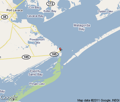
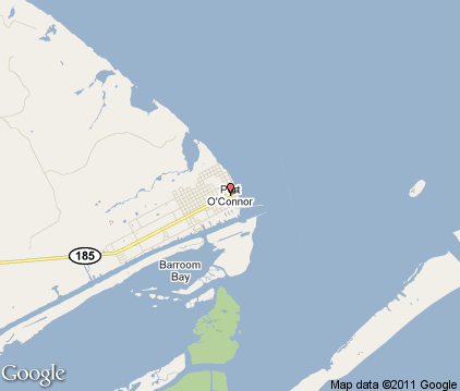
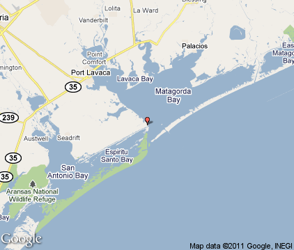
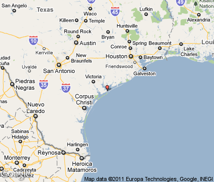
is an unincorporated village on the southeast coast of Texas. It lies between Galveston and Corpus Christi. The entire zip code area that includes Port O'Connor was 1,253 as of the 2010 census. Called "the best kept secret on the Gulf Coast," the main industries of Port O'Connor are tourism, sport fishing and shrimping. Fishing enthusiasts come to the area for the bay and off-shore fishing of trout, flounder, marlin and redfish. Port O'Connor offers easy and quick access to the Gulf of Mexico via Pass Cavallo. Hunters also frequent Port O'Connor to hunt geese, duck and alligator. Other things to do in the area include sailing, boating, kayaking, birding, beachcombing and just relaxing on the quiet beaches. From Port O'Connor, it's just a quick boat ride to Matagorda Island and Sunday Beach. Port O'Connor is in the direct path of migration for over 300 species of birds, making this a popular birding destination. Port O'Connor was charted in the late 1800s as a fishing village. It was originally called Alligator Head. The village was hit hard by hurricanes four times in history, but slowly rebuilt each time.

|
Port Oconnor Vacation Rentals
|

|
|
|

|
Port Oconnor Hotels and Resorts
|

|
|
| | | Hotels & Motels |
| Executive Inn | 2007 N Hwy 35 | Port Lavaca, TX | 24.0 mi. | (361) 552-1300 |

|
Port Oconnor Weather & Climate
|

|
|
|
Southeast Texas has a subtropical humid climate with hot summers and mild winters. This region is one of the hottest in the state of Texas. From June through September, the temperature is generally always above 90 degrees F., and it's not uncommon for it to soar over 100 degrees. High humidity makes it even more uncomfortable. Winters, on the other hand, are mild and pleasant. Thunderstorms are possible in spring and sometimes bring tornadoes to the area. Snowfall is very rare, although it does occur once every couple of years or so. The average high in January is 63 degrees F. Average annual rainfall in this area is 50 inches. Flash flooding sometimes occurs when storms dump large amounts of rain in a short period of time.
|
| Month |
High Temp |
Low Temp |
Rainfall |
Ocean Temp |
| January |
60°F |
47°F |
3.07 in. |
- |
| February |
63°F |
51°F |
2.20 in. |
- |
| March |
69°F |
58°F |
1.73 in. |
- |
| April |
75°F |
64°F |
1.55 in. |
- |
| May |
80°F |
72°F |
3.70 in. |
- |
| June |
86°F |
77°F |
2.77 in. |
- |
| July |
88°F |
79°F |
3.05 in. |
- |
| August |
89°F |
78°F |
2.94 in. |
- |
| September |
86°F |
75°F |
4.97 in. |
- |
| October |
81°F |
67°F |
4.45 in. |
- |
| November |
71°F |
58°F |
2.53 in. |
- |
| December |
64°F |
49°F |
1.82 in. |
- |

|
Port Oconnor Map & Transportation
|

|
|
 |
|
|
| Click each thumbnail image to enlarge. |
 |
 |
 |
 |
The closest airports in the area are the Calhoun County airport (PKV) located about 21 miles northwest of Port Oconnor in Port Lavaca, Texas, the Palacios Municipal airport (PSX) located approximately 21 miles northeast of Port Oconnor in Palacios, Texas, the Victoria Regional airport (VCT) located roughly 41 miles northwest of Port Oconnor in Victoria, Texas, the Aransas County airport (RKP) located around 46 miles southwest of Port Oconnor in Rockport, Texas, the Bay City Municipal airport (BYY) located about 48 miles northeast of Port Oconnor in Bay City, Texas, the Wharton Regional airport (5R5) located approximately 57 miles northeast of Port Oconnor in Wharton, Texas, the T P Mc Campbell airport (T43) located roughly 61 miles southwest of Port Oconnor in Ingleside, Texas, and finally the Brazoria County airport (LBX) located around 73 miles northeast of Port Oconnor in Angleton / Lake Jackson, Texas.
|

|
Port Oconnor Attractions
|

|
|
| | | Golf Courses |
| Hatch Bend Country Club | Port Lavaca | TX | 17.1 mi. | | | Palacios Golf Club | Palacios | TX | 21.1 mi. | |
| | | Zoos and Aquariums |
| The Texas Zoo | Victoria | TX | 43.8 mi. | | | Texas State Aquarium | Corpus Christi | TX | 75.2 mi. | | | Houston Zoological Gardens | Houston | TX | 110.5 mi. | | | Rainforest at Moody Gardens | Galveston | TX | 113.8 mi. | |
Notice a problem with the information on this page? Please notify us.
|
Disclaimer: We recommend you conduct your own research regarding all accomodations and attractions found on this website. The distances shown on this website are straight-line distances as the crow flies. The road distance may be considerably longer. You assume all liability for use of any information found on this website. No information is confirmed or warranted in any way. By using our services you agree to the terms and conditions of this disclaimer.
|
| We are the #1 site for your Texas Vacations presenting Texas vacation rentals, hotels, weather and map for each city. |
Texas Vacations .com
©1997-2025 All Rights Reserved.
|
|